Vintage cartography offers a fascinating way to explore cities and countries through the eyes of earlier generations. Long before digital maps, satellite imagery, and interactive navigation systems, maps were carefully created by explorers, surveyors, artists, and publishers who recorded landscapes using the knowledge available to them. These historic maps are more than practical guides to roads and borders. They preserve stories about changing cities, forgotten neighborhoods, political boundaries, trade routes, waterways, and the ways people understood the world around them.
Today, vintage maps attract historians, travelers, collectors, interior designers, researchers, and anyone interested in discovering the past. Studying an old map can reveal how a familiar destination looked centuries ago and how dramatically communities have developed over time. From detailed city plans to expansive world maps, vintage cartography creates a bridge between modern geography and historical exploration.
Understanding the Meaning of Vintage Cartography
Vintage cartography refers to maps produced during earlier periods that have historical, artistic, or cultural significance. Depending on their age, purpose, and origin, these maps can show countries, cities, provinces, coastlines, transportation routes, political territories, and natural landscapes.
Historic cartographers worked with very different resources compared with modern mapmakers. Information often came from travelers, military surveys, local records, maritime observations, and earlier maps. As new discoveries were made, geographical knowledge developed, and maps were revised accordingly.
The result is a fascinating collection of documents that reflects both geographic information and the historical circumstances of the time. A vintage map may show a location accurately for its period while also containing outdated names, boundaries, or geographical assumptions. These details make historic maps particularly valuable for understanding how places were perceived and documented.
Discovering Cities Through Old Maps
Cities are among the most interesting subjects in vintage cartography because urban landscapes can change considerably within a few generations. Streets may be extended, neighborhoods may disappear, rivers may be redirected, and new public buildings may transform the appearance of an entire district.
An old city map can provide a snapshot of urban life at a particular moment. It may reveal street names that no longer exist, former marketplaces, historic railway lines, old ports, public squares, fortifications, and residential districts.
For someone familiar with a modern city, comparing a vintage map with a contemporary map can become an exciting historical exercise. A street that appears ordinary today may once have marked the edge of a growing settlement. A large modern district might have once been farmland or undeveloped land.
Vintage city maps therefore allow people to explore familiar destinations from an unfamiliar perspective.
Exploring Countries Through Historical Maps
Vintage cartography is equally valuable for understanding countries and their changing territories. National borders have not always remained fixed. Political agreements, wars, independence movements, administrative changes, and territorial reorganizations have all influenced the way countries appeared on maps.
Historical country maps can show former provinces, kingdoms, colonies, territories, and administrative regions. They may also display older names for cities and geographic features. By examining maps from different periods, researchers can trace the development of political geography and understand how modern countries emerged.
These maps are especially useful when studying regions with complex histories. A sequence of maps can demonstrate how boundaries moved and how different geographic names were used over time.
The Artistic Side of Vintage Cartography
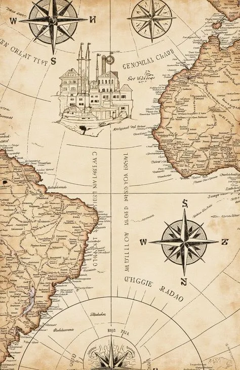
Vintage maps are appreciated not only for their information but also for their visual character. Many historic maps were designed with remarkable attention to typography, illustrations, decorative borders, compass roses, symbols, and geographic details.
Older mapmakers often treated maps as both functional documents and works of visual communication. Mountains could be illustrated with small engraved symbols, ships might appear in oceans, and important buildings could be represented through decorative drawings.
The lettering used on historic maps is another important feature. Different typefaces and hand-drawn labels give each map a distinctive personality. Even small details, such as border patterns and decorative elements, can reveal the artistic traditions of the period.
This combination of geography and artistry makes vintage cartography appealing to people who may not initially consider themselves interested in maps.
Following the Development of Transportation
Transportation is another fascinating subject revealed through vintage maps. As roads, canals, railways, and shipping routes developed, cartographers recorded these changes to help people understand movement across cities and countries.
Railway maps can be particularly valuable because they show how transportation networks expanded and connected communities. A route that once represented a major connection between two cities may have disappeared, while another line may have become an important modern corridor.
Road maps can similarly reveal the growth of highways and regional connections. Comparing maps from different periods allows viewers to see how transportation influenced urban expansion and economic activity.
For travelers and researchers, these maps provide a historical perspective on journeys that may now be completed using modern transportation systems.
Vintage Maps as Historical Records
A map can function as a historical record because it captures information about a place at a particular moment. It can show political boundaries, settlement patterns, land use, transportation routes, and geographic names.
Historians often use maps alongside written documents to understand past events. A historical description may mention a particular neighborhood, road, river, or building, while a map can show exactly where that feature was located in relation to other places.
This makes cartographic material useful for studying local history, urban development, military campaigns, exploration, trade, and migration.
Even seemingly small details can become meaningful. A tiny settlement marked on an old map may later become a major city, while another location may have disappeared entirely.
Seeing Forgotten Place Names
Place names change for many reasons. Political transitions, language changes, cultural developments, and administrative decisions can all result in new names.
Vintage maps preserve earlier versions of these names. For researchers, this can be extremely useful when attempting to identify locations mentioned in old documents.
A modern traveler might recognize only the current name of a city, while a historical map may reveal several earlier names used by different generations. These differences provide insight into the cultural and political history of a region.
Old geographic names also help explain why historical documents sometimes appear difficult to connect with modern locations. Vintage cartography provides an important reference point between past and present terminology.
Exploring Coastlines and Waterways
Rivers, lakes, coastlines, and canals have played central roles in the development of cities and countries. Vintage maps allow viewers to study how these features were represented in earlier periods.
Some maps provide remarkable detail about ports, river crossings, islands, harbors, and maritime routes. Others reveal how cartographers understood coastlines before modern surveying technology became available.
Changes in waterways can also be historically significant. A river may have been redirected, a canal may have been constructed, or a harbor may have expanded. Comparing old and modern maps can reveal these transformations and demonstrate how communities adapted their surroundings to transportation, commerce, and urban growth.
Understanding Historical Exploration
Many vintage maps are connected to the history of exploration. As travelers visited unfamiliar regions, new information gradually became available to mapmakers. Early maps therefore provide evidence of how geographic knowledge expanded.
Exploration maps can contain fascinating clues about the knowledge available at the time. Some areas may be highly detailed, while distant regions may be represented with limited information.
Studying these maps helps modern audiences understand that geographic knowledge developed gradually. What seems obvious on a modern digital map may once have required years of travel, surveying, observation, and documentation.
The Importance of Map Collecting
Collecting vintage maps can become a rewarding way to build a personal historical library. Collectors may focus on a particular city, country, time period, cartographer, publisher, or subject.
Some collectors prefer maps connected to family history or places they have visited. Others concentrate on decorative examples because of their artistic qualities.
The condition, rarity, age, historical importance, geographic coverage, and provenance of a map can all influence its interest to collectors. However, the value of a vintage map is not limited to monetary considerations. A map connected to a meaningful location can have considerable personal significance.
Vintage Maps in Interior Design
Vintage cartography has also become popular as a decorative choice for homes, offices, libraries, hotels, restaurants, and educational spaces. A large historical map can create a distinctive focal point while introducing a sense of travel and history.
City maps are particularly suitable for spaces connected to a specific location. A historic map of a hometown, birthplace, favorite destination, or important business location can add a personal dimension to an interior.
World maps and regional maps can similarly create an atmosphere associated with exploration and discovery.
Their visual appeal comes from the combination of typography, geographic shapes, illustrations, and historical character.
Using Vintage Cartography for Education
Maps can make historical education more engaging because they allow students to see geographic change rather than simply read about it. Teachers can use historic maps to demonstrate changing borders, urban expansion, transportation development, and exploration.
Students can compare maps from different periods and identify changes in streets, settlements, political territories, and geographic names.
This approach encourages observation and critical thinking. Instead of treating a map as a simple picture, students learn to ask when it was created, who created it, what information it contains, and what may be missing.
Comparing Vintage and Modern Maps
One of the most enjoyable ways to appreciate vintage cartography is to compare an old map with a modern representation of the same location.
Modern maps provide extensive geographic detail and practical navigation information. Vintage maps provide historical context and a record of how a location appeared at an earlier point in time.
Together, they tell a richer story. A modern map might show a large metropolitan area filled with roads and buildings, while an older map may reveal the small settlement that existed before that expansion.
This comparison transforms geography into a story of change.
Preserving Cartographic Heritage
Historic maps are fragile records that deserve careful preservation. Paper can deteriorate over time because of handling, environmental conditions, and storage problems. Proper preservation helps ensure that these documents remain available for future generations.
Digitization has also expanded access to historic cartography. High-quality digital reproductions allow researchers and enthusiasts to study maps without repeatedly handling delicate originals.
Preservation is important because every map represents a piece of geographic history. Once an original document is damaged or lost, information contained within its physical features may become difficult to recover.
Why Vintage Cartography Still Matters Today
Modern technology has made navigation faster and more convenient, but it has not reduced the historical importance of traditional maps. Instead, digital tools have created new opportunities to study and compare vintage cartography.
Historic maps help people understand that cities and countries are constantly changing. Streets, borders, names, transportation networks, and settlements all reflect the decisions and events of previous generations.
For travelers, vintage maps can make destinations more meaningful. For historians, they provide valuable evidence. For collectors, they offer fascinating objects connected to the past. For designers, they provide distinctive visual artwork.
Most importantly, vintage cartography encourages curiosity. It invites viewers to look beyond the present appearance of a place and ask what stood there before, how it developed, and what stories may be hidden within its streets and landscapes.
Conclusion
Exploring cities and countries through vintage cartography offers a unique journey through geography and history. Every old map captures a particular moment and preserves details that may no longer be visible in the modern landscape. From changing city streets and former borders to historic transportation routes and forgotten place names, these maps reveal the evolution of communities around the world.
Vintage cartography combines research, art, exploration, and storytelling in a single format. Whether displayed as a collectible, studied for historical research, or used to compare past and present landscapes, an old map can transform the way we understand a familiar destination.
Looking at a vintage map is ultimately an invitation to travel through time. It encourages us to see cities not simply as places that exist today, but as constantly evolving landscapes shaped by generations of people, movement, discovery, and change.