In the competitive landscape of subsea asset management, the ability to transition from simple visual observations to verifiable engineering data is a primary differentiator. Historically, underwater inspections relied on video logs that, while descriptive, lacked the spatial context required for rigorous dimensional analysis. Today, the convergence of high-resolution optics and advanced computational geometry has introduced a new era of digital documentation, allowing stakeholders to interact with submerged assets as if they were standing directly beside them.
The Mechanics of Precision: Understanding 3D Photogrammetry
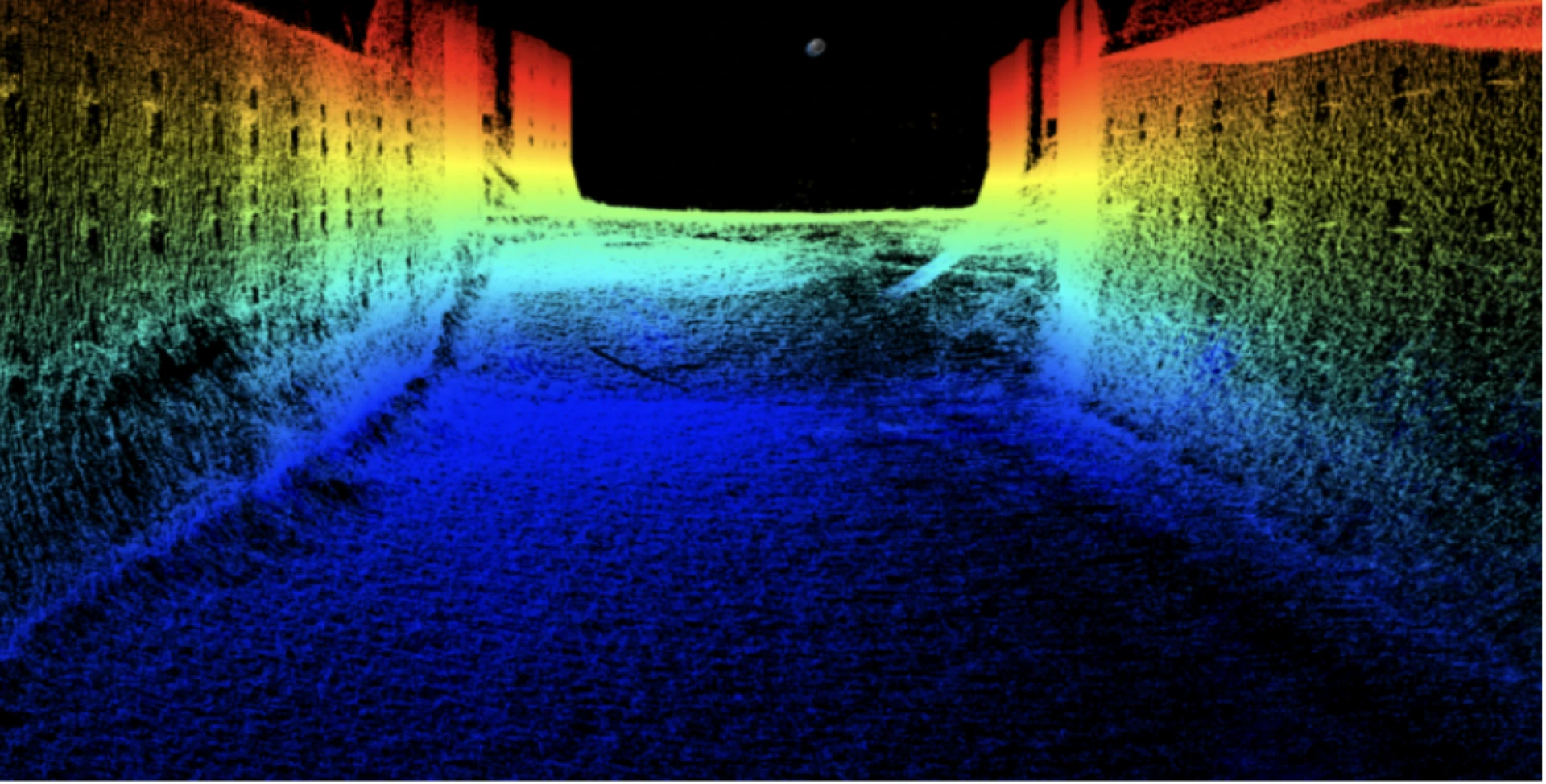
At its core, 3D photogrammetry is a sophisticated process that translates two-dimensional image data into a three-dimensional coordinate system. By capturing a high volume of overlapping photographs from varying perspectives, software identifies and triangulates common features across the data set to calculate precise spatial coordinates.
This technique produces high-density point clouds, textured surface meshes, and orthomosaic images. In industrial contexts, 3D photogrammetry enables non-contact metrology, providing a safer and more comprehensive alternative to manual measurements. It is a highly scalable solution, capable of documenting everything from a single cathodic protection anode to the entire submerged face of a hydroelectric dam or bridge pier. 3D photogrammetry serves as the foundation for modern digital twins, supporting as-built verification and long-term asset lifecycle documentation.
Mastering the Subsea Environment
When these principles are applied beneath the surface, the complexity increases significantly due to the unique optical properties of water, including light attenuation, color absorption, and the refractive index of camera housing ports. Successful underwater photogrammetry requires specialized lighting arrays and precision positioning to ensure systematic image acquisition.
Ven-Tech Subsea utilizes a multidisciplinary robotic fleet equipped with 4K video capture to overcome these environmental hurdles. By integrating underwater photogrammetry into a multi-sensor platform, data can be georeferenced and cross-referenced with sonar and positioning sensors. This integrated data collection approach ensures that the resulting models are not only visually photorealistic but also dimensionally accurate for engineering review, even in dynamic marine environments.
Strategic Applications and Deliverables
Modern subsea documentation provides a permanent digital record that supports the entire lifecycle of an asset. Underwater photogrammetry is currently revolutionizing several key areas:
- Offshore Energy: Accurate measurement of free spans on pipelines and structural damage documentation on wellheads.
- Infrastructure & Ports: Detailed condition assessments of bridge piers and fender systems for maintenance planning.
- Marine Construction: As-built verification to ensure subsea installations match original CAD designs.
- Archaeological Documentation: Comprehensive mapping of shipwreck sites and cultural heritage artifacts without physical disturbance.
The final deliverables—including XYZ point clouds, mesh models, and CAD-compatible exports (OBJ, STL, DXF)—allow remote experts to collaborate without the need for expensive mobilization. This capability supports precise change detection, where multiple surveys are compared over time to monitor corrosion rates or structural deformation.
At Ven-Tech Subsea, we leverage 11+ years of operational excellence to turn complex subsea imagery into "Subsea Confidence." While this technology requires adequate visibility to be effective, it remains one of the most powerful tools in a modern inspection toolkit when combined with traditional sonar and visual methods.