Mobile Mapping is reshaping the world of surveying, why it matters, and how it’s being applied in real-world scenarios to tackle everything from urban planning to environmental monitoring.
How Mobile Mapping Enhances Surveying
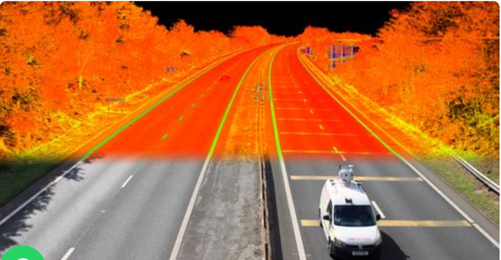
Traditional land surveys typically require teams of professionals to physically measure distances, angles, and elevations using total stations or theodolites. While these methods are still reliable, they are labor-intensive, time-consuming, and often limited in scope. Mobile Mapping, by contrast, allows for:
High-Speed Data Collection: Mobile Mapping systems can capture tens of thousands of measurements per second while traveling at normal traffic speeds, making it ideal for surveying roadways, cities, and infrastructure corridors.
Improved Accuracy and Coverage: Combining multiple sensor types allows for extremely accurate spatial data, even in complex or obstructed environments.
Enhanced Safety: Surveyors no longer need to work directly in hazardous areas like busy roads, construction zones, or unstable terrain.
Cost-Effective Surveys: Faster data collection and reduced manpower translate into lower costs and more efficient project timelines.
Applications of Mobile Mapping in Modern Surveying
Mobile Mapping is being embraced across a variety of sectors for different types of surveys. Here are a few examples:
Urban Planning and Smart Cities
Planners use Mobile Mapping to survey streets, utilities, buildings, and traffic patterns in real-time. The collected data feeds into digital city models used for infrastructure upgrades, zoning decisions, and smart city development.
Transportation and Roadway Management
Departments of transportation use Mobile Mapping to assess road conditions, identify wear and tear, and plan maintenance. It’s also used to survey newly constructed highways or railway systems before they open to the public.
Environmental and Disaster Surveys
After events such as floods, earthquakes, or wildfires, Mobile Mapping vehicles can be quickly deployed to assess damage, map affected areas, and support recovery efforts without putting human surveyors in danger.
Construction and Engineering
Engineers use Mobile Mapping to perform progress surveys, verify construction against blueprints, and create as-built documentation. This ensures precision and reduces the risk of costly rework.
NSE Dubai’s Role in Smart Infrastructure
As one of the key players in Dubai’s economic and technological ecosystem, NSE Dubai (Nasdaq Dubai) indirectly supports advancements in urban tech by creating investment opportunities in infrastructure and smart technologies. Through listings of tech-driven companies and infrastructure funds, the exchange helps channel capital into projects that rely on precise and modern surveying methods like Mobile Mapping.Conclusion: Mapping the Smart Cities of Tomorrow
The integration of Mobile Mapping into modern surveying practices marks a significant step toward building cities that are not only intelligent but also safe, sustainable, and responsive to the needs of the future.