In today’s fast-moving construction landscape, precision is everything. From setting out a residential building to designing major road and rail infrastructure, accurate engineering surveying ensures every project begins on the right foundation.
At 2Survey, we combine advanced technology, experienced surveyors, and local knowledge to deliver reliable construction surveying services and underground service locating surveys across Australia. Our mission is simple — to provide data-driven accuracy that keeps projects safe, compliant, and on schedule.

What Is Engineering Surveying and Why Is It Crucial?
Engineering surveying is the science of measuring, mapping, and positioning the physical environment to support the design, construction, and maintenance of infrastructure. It bridges the gap between planning and construction — ensuring the concept on paper aligns perfectly with the reality on-site.
Core purposes of engineering surveying include:
- Establishing accurate horizontal and vertical control points
- Monitoring structural movement and deformation
- Mapping terrain for design and planning
- Supporting infrastructure projects such as roads, railways, tunnels, and bridges
At 2Survey, our engineering surveyors use advanced GNSS, robotic total stations, laser scanning, and drones to capture and model data with millimeter precision.
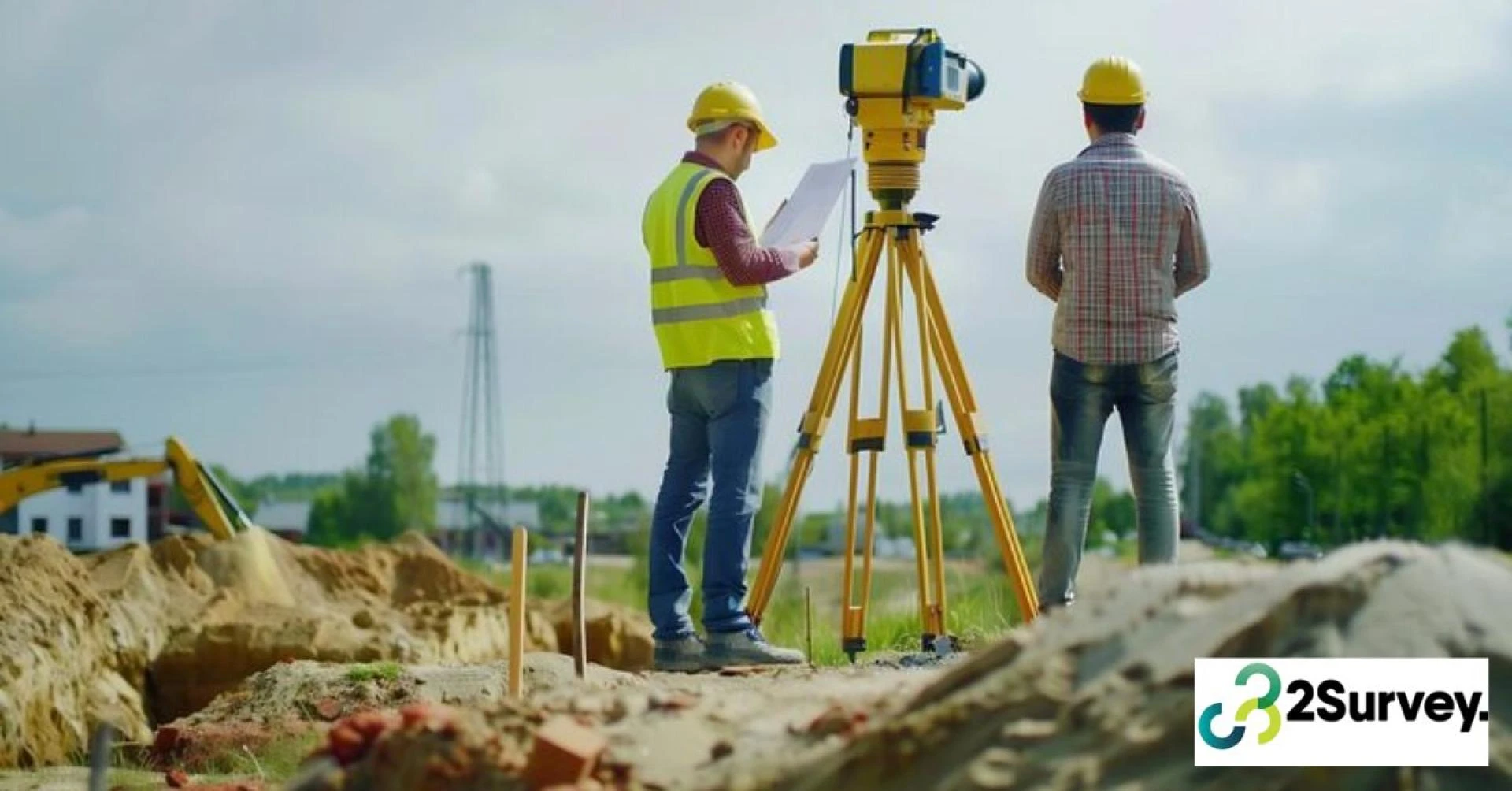
Construction Surveying Services: Bringing Design to Life
Every successful construction project depends on the accuracy of its survey data. Construction surveying services ensure that the design plans are correctly transferred onto the ground, guiding builders and engineers through every stage of development.
Our construction surveying expertise includes:
- Set-out surveys: Precisely marking design points for construction works.
- As-built surveys: Verifying that completed work matches design specifications.
- Level and alignment checks: Ensuring foundations and structural components meet tolerance standards.
- Volume and earthwork surveys: Calculating material movement for cost and logistics planning.
2Survey’s team works closely with project managers, civil engineers, and contractors to reduce errors, prevent rework, and improve construction outcomes. Our data ensures that every line, corner, and level is right — the first time.
Underground Service Locating Surveys: Safety Before Shovels
Before any excavation begins, it’s essential to know what lies beneath the surface. Damaging underground utilities can cause serious safety risks, project delays, and costly repairs.
That’s why 2Survey provides underground service locating surveys using non-destructive technologies like Ground Penetrating Radar (GPR) and electromagnetic detection.
Our underground locating process includes:
- Identifying and mapping underground utilities (gas, water, sewer, electrical, telecoms)
- Providing digital and CAD plans for safe excavation planning
- Reducing the risk of damage and ensuring compliance with Dial Before You Dig guidelines
By integrating these surveys with engineering and construction data, we offer a complete picture of the site’s visible and hidden features — allowing safer, smarter project execution.
Why Choose 2Survey for Engineering and Construction Projects?
Choosing the right surveyor isn’t just about cost — it’s about confidence in data. 2Survey stands apart through a combination of technology, expertise, and a people-first approach.
What sets 2Survey apart:
- Accuracy You Can Trust: Using the latest GNSS, LiDAR, and drone technology for precise results.
- Comprehensive Services: From boundary and topographic surveys to complex rail and civil infrastructure.
- Safety and Compliance: Fully accredited and compliant with national survey standards.
- Client-Centric Approach: We collaborate closely with clients to tailor solutions for every project scale.
- Australia-Wide Capability: Delivering consistent quality from urban developments to remote infrastructure sites.
Our surveyors understand that construction timelines are tight — which is why 2Survey delivers results quickly without compromising quality.
The Future of Engineering Surveying: Smart, Digital, and Sustainable
Surveying is evolving fast, and 2Survey is at the forefront of that transformation. Emerging tools like 3D laser scanning, Building Information Modelling (BIM) integration, and AI-driven geospatial analysis are making surveying faster, smarter, and more sustainable.
We’re committed to adopting innovative technologies that:
- Improve data accuracy and accessibility
- Support green and sustainable construction practices
- Reduce rework and material waste through predictive modelling
By embracing digital transformation, 2Survey ensures our clients are always ahead — ready for the next generation of infrastructure development.
Conclusion: Your Partner in Precision
Whether you’re designing a highway, constructing a commercial complex, or preparing a residential site, accurate surveying is the backbone of every successful build.
At 2Survey, we don’t just measure — we deliver insight, reliability, and confidence. From engineering surveying to construction surveying services and underground service locating surveys, our experts ensure every project stands on the firm ground of precision and trust.
Partner with 2Survey — where accuracy builds the future.
Frequently Asked Questions (FAQ)
Q1: What is the difference between engineering and construction surveying?
Engineering surveying focuses on measuring and mapping data for design, while construction surveying applies that data to guide on-site building works.
Q2: Why are underground service locating surveys important?
They identify buried utilities to prevent damage, ensuring safety and compliance during excavation.
Q3: How often should surveying be done on a construction site?
It should be conducted before, during, and after major construction stages to ensure ongoing accuracy.
Q4: Does 2Survey provide digital deliverables?
Yes, we offer CAD, GIS, and BIM-compatible survey outputs for seamless project integration.