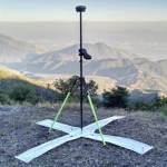
Precision is essential while doing aerial mapping and surveying. Professionals use a range of methods and tools to get precise and trustworthy outcomes. The use of Ground Control Points (GCPs) is an essential component of this procedure. In order to accurately and effectively complete aerial mapping tasks, it is crucial to match aerial photos with actual geographic coordinates. In this blog article, we will dig into the realm of ground control points and examine their function, significance, and role in producing accurate aerial maps.
Recognising Ground Control Points
Ground control points, or GCPs for short, are physical markers that are carefully positioned on the ground to create exact reference points for aerial mapping and surveying operations. These markers serve as precisely measured and known ground-based coordinates. Professionals can remove errors, account for topographic relief, and precisely scale and georeference the aerial photography by linking these known points with their respective locations in the aerial picture.
GCPs are primarily used to improve the precision of orthomosaics, digital surface models (DSMs), and aerial maps. GCPs remove mistakes brought on by distortion, camera lens flaws, altitude fluctuations, and other elements inherent in aerial imaging by connecting the images to actual geographic coordinates. They offer a trustworthy framework for integrating the acquired aerial data with a geospatial reference system, guaranteeing accurate geographic information in the maps and models that arise.
Ground control point placement and characteristics
For proper mapping, GCP placement must be well thought out. These locations have to be spread out throughout the whole region of interest and include a variety of heights and terrain types. According to the project requirements, a sufficient number of GCPs should be installed to achieve the highest level of accuracy.
Ground control points can be painted targets, retroreflective targets, survey markers, specifically crafted targets with programmed patterns, or any other type of target. The topography, vegetation, project scope, and the particular mapping tools being utilised are all variables that affect the choice of GCP type. Regardless of kind, GCPs should have known and carefully studied positions, be simple to discern in aerial images, and be able to move.
Processing Data Workflows
The steps involved in using ground control points are generally as follows:
- Survey preparation: Based on the needs of the project, choose the right number of GCPs, their location, and the necessary level of precision.
- Ground surveying: Using high-precision GPS technology or total stations, surveyors measure and record the exact coordinates of each GCP.
- Data collection from the air: Photogrammetric methods are used to collect aerial imagery from human or unmanned aerial vehicles (UAVs).
- When georeferencing a picture, distortions and scale problems are fixed by aligning the aerial images with physical places using GCP coordinates.
- Quality control: By comparing the location of additional checkpoints (additional ground reference points) with their known coordinates, the correctness of the georeferenced aerial maps and models is evaluated.
Conclusion
An essential part of aerial mapping and surveying efforts are ground control stations. GCPs allow for the construction of precise and geographically accurate maps and models by creating precise reference points on the ground and connecting them to aerial photography. These markers aid in removing distortions, accounting for differences in relief, and provide a solid framework for spatial data processing. Cartography, urban planning, environmental monitoring, and infrastructure development will all undergo radical changes as a result of the integration of GCPs with cutting-edge photogrammetric techniques and remote sensing technologies as technology develops.


