


The evolution of drone technology has transformed the way industries operate, especially in surveying and mapping. Today, using drones for mapping has become an integral part of modern land survey projects, providing accuracy, efficiency, and cost-effectiveness that traditional methods struggle to match. The introduction of ortho mapping drone technology has further revolutionized how we capture, process, and analyze geographical data, leading to faster and more precise results.
The Rise of Drone Technology in Mapping
For centuries, land surveyors relied on manual measurements, optical instruments, and satellite data to map terrains. However, these methods were often time-consuming and lacked precision, particularly in challenging environments. The integration of drones into surveying has been a game-changer. Equipped with high-resolution cameras, LiDAR sensors, and GPS technology, drones can capture large areas from the sky, producing detailed and accurate maps in a fraction of the time.
Using drones for mapping enables surveyors to collect high-quality aerial imagery and convert it into georeferenced data that supports a range of applications—from construction and agriculture to urban planning and environmental monitoring. This efficiency not only saves time but also reduces labor costs and minimizes human error.
What is Ortho Mapping Drone Technology?
An ortho mapping drone is a specialized drone designed to create orthomosaic maps—highly accurate, geometrically corrected aerial images that represent the Earth's surface without distortion. Unlike standard aerial photographs, orthomosaic maps are created by stitching together multiple overlapping images, corrected for topographic relief and camera tilt. This ensures that the scale is uniform across the entire image, making it suitable for precise measurements and analysis.
The process typically involves three key stages:
- Image Capture – The drone flies over the target area, capturing multiple overlapping photos from different angles.
- Data Processing – Specialized software processes these images, aligning and correcting them using GPS coordinates and ground control points.
- Map Generation – The final orthomosaic map is created, providing surveyors with an accurate, measurable representation of the land.
This technology allows for centimeter-level accuracy, enabling professionals to assess terrain, plan construction layouts, and monitor environmental changes with exceptional precision.
Key Benefits of Using Drones for Mapping
1.High Accuracy and Detail
Drones equipped with advanced sensors and imaging technology deliver incredibly detailed data. Using drones for mapping provides high-resolution imagery that captures every contour and elevation, essential for applications like infrastructure planning and land development.
2.Time Efficiency
Traditional land surveying methods can take days or even weeks, especially for large or complex areas. Drones, on the other hand, can cover vast expanses within hours, drastically reducing project timelines and boosting productivity.
3.Cost-Effectiveness
Drone-based mapping eliminates the need for heavy machinery, multiple personnel, and prolonged fieldwork. The result is a more affordable and scalable solution for surveying projects of all sizes.
4.Safety and Accessibility
Surveying dangerous or hard-to-reach areas, such as cliffs, forests, or construction sites, poses safety risks. Drones can easily access these zones from the air, ensuring accurate data collection without endangering personnel.
5.Enhanced Data Analysis
The data obtained from ortho mapping drone technology can be integrated with GIS (Geographic Information Systems) for advanced spatial analysis. This helps planners and engineers make informed decisions based on real-time, reliable information.
6.Environmental Benefits
Drones operate with minimal environmental disturbance. Their ability to conduct aerial mapping without altering the natural landscape makes them ideal for ecological surveys and environmental conservation projects.
Applications of Drone Mapping in Different Industries
1.Construction and Infrastructure Development
Drones are redefining the way construction projects are planned and monitored. Using drones for mapping allows project managers to visualize site conditions, monitor progress, and ensure compliance with design specifications. Orthomosaic maps assist in volume calculations, grading assessments, and detecting potential discrepancies before they become costly problems.
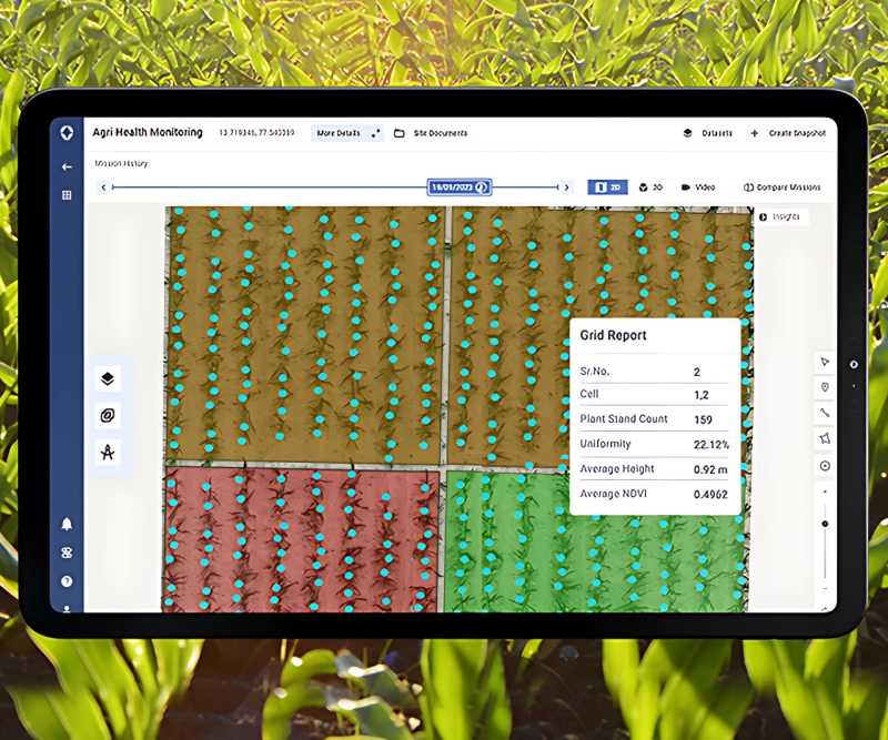
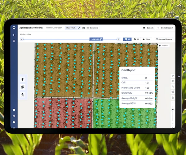
2.Agriculture and Forestry
Farmers and foresters benefit immensely from ortho mapping drone applications. Drones can monitor crop health, assess soil conditions, and map irrigation systems with pinpoint accuracy. Orthomosaic maps help in identifying problem areas, optimizing resources, and increasing overall yield.
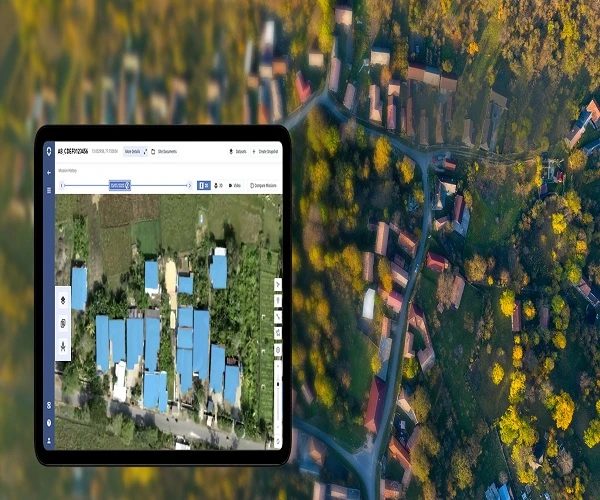
3.Urban Planning and Real Estate
Urban planners use drone mapping to create accurate 3D models of cities, roads, and infrastructure. Real estate developers rely on these visuals to plan new projects, evaluate property layouts, and present data to stakeholders.
4.Mining and Quarrying
In the mining sector, drone mapping assists in monitoring pit operations, stockpile volumes, and safety compliance. The data helps optimize extraction processes and reduce environmental impact.
5.Disaster Management and Environmental Monitoring
Drones play a vital role in assessing natural disasters such as floods, landslides, or earthquakes. Orthomosaic maps provide detailed views of affected areas, enabling faster and more effective response strategies. Environmental agencies also use drones to track deforestation, erosion, and habitat changes over time.
6.Transportation and Utilities
Using drones for mapping helps in designing roadways, railways, and pipelines by providing accurate terrain data. Utility companies use drone-based mapping to inspect power lines, wind turbines, and solar farms without the need for manual climbs or shutdowns.
The Process of Drone Survey Data Collection
A typical ortho mapping drone project follows a structured process:
- Planning: Defining the survey area, flight path, and altitude.
- Data Collection: Capturing high-overlap images using automated drone flight software.
- Data Processing: Using photogrammetry software to create a 2D orthomosaic or 3D terrain model.
- Analysis and Reporting: Extracting measurements, contours, and digital elevation models for project use.
Each step contributes to producing reliable, actionable insights that support decision-making across multiple sectors.
The Future of Drone-Based Mapping
The future of mapping lies in automation and artificial intelligence. Drones integrated with AI and machine learning algorithms are capable of autonomous navigation, real-time data processing, and predictive analysis. These advancements will make using drones for mapping even more efficient, reducing human intervention and increasing accuracy.
Additionally, as regulatory frameworks evolve, the use of Beyond Visual Line of Sight (BVLOS) operations will allow drones to cover larger areas and collect more comprehensive data sets. Combined with cloud-based processing, real-time data sharing will become the new standard in the mapping industry.
Conclusion
As technology continues to evolve, using drones for mapping is no longer a futuristic concept but a mainstream solution transforming the surveying landscape. The precision and versatility of ortho mapping drone systems have redefined how industries approach data collection and land assessment, offering faster, safer, and more cost-effective alternatives to traditional methods.
For organizations looking to harness the power of drone mapping, partnering with experts in advanced drone technology ensures superior results. Companies like Asteria Aerospace are at the forefront of this transformation, providing innovative drone solutions that empower industries to make smarter, data-driven decisions while revolutionizing how we map the world.