

Surveying is one of the oldest professions in human history, dating back to ancient civilizations that needed accurate measurements to build monuments, establish boundaries, and manage land. The tools used by surveyors have changed dramatically over time, reflecting advances in science, engineering, and technology. From rudimentary chains and compasses to modern GPS receivers and drones, surveying equipment has evolved to meet the growing demands of precision and efficiency in construction and land management. This article explores the journey of surveying equipment, highlighting the shift from traditional tools to digital solutions.
Traditional Tools in Surveying
1. Measuring Chains and Tapes
One of the earliest tools in surveying was the measuring chain, often made of iron links. These chains were used to measure distances in land surveys. Later, steel or cloth measuring tapesbecame popular for their portability and ease of use. While simple, these tools were prone to errors caused by stretching, sagging, or uneven terrain.
2. Compasses
Compasses were essential for determining directions and bearings. They allowed surveyors to establish orientation and align measurements with cardinal points. Though limited in precision, compasses were invaluable in early exploration and mapping.
3. Levels
Levels, such as the spirit level and dumpy level, were used to determine elevations and height differences. These instruments relied on optical systems and manual adjustments, requiring skill and patience to achieve accurate results.
4. Theodolites
Introduced in the 16th century, the theodolite became a cornerstone of traditional surveying. It allowed surveyors to measure both horizontal and vertical angles with greater accuracy than earlier tools. Theodolites were crucial in triangulation surveys, which formed the basis of national mapping systems.
Transition to Mechanical and Optical Innovations
By the 19th and early 20th centuries, surveying equipment began incorporating mechanical and optical improvements. Precision instruments with finely calibrated scales and lenses enhanced accuracy. For example:
- Plane tables allowed surveyors to plot data directly in the field.
- Transit theodolites improved angle measurement with rotating telescopes.
- Automatic levels simplified elevation measurements by reducing manual adjustments.
These innovations marked a significant step forward, but surveys still relied heavily on manual recording and calculations.
The Digital Revolution in Surveying
The late 20th century ushered in a digital revolution that transformed surveying practices. Instruments became electronic, integrating computing power and data storage capabilities.
1. Electronic Distance Measurement (EDM)
EDM devices replaced chains and tapes by using electromagnetic waves to measure distances with high precision. They eliminated many of the errors associated with manual tools and allowed surveyors to measure long distances quickly.
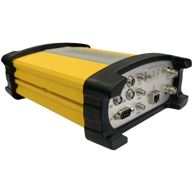
2. Total Stations
A total station combined the functions of a theodolite and EDM into a single device. It could measure angles, distances, and coordinates simultaneously, storing data electronically for later processing. Robotic total stations further enhanced efficiency by enabling one‑person operation.
3. Global Positioning System (GPS)
GPS technology revolutionized surveying by providing real‑time positioning with centimeter‑level accuracy. Survey‑grade GPS receivers, especially when paired with Real‑Time Kinematic (RTK) systems, became indispensable for geodetic surveys, construction projects, and land development.
Modern Digital Solutions
1. Drones (Unmanned Aerial Vehicles)
Drones equipped with cameras and LiDAR sensors have transformed surveying by providing aerial imagery and 3D mapping capabilities. They are particularly useful for surveying large or inaccessible areas, offering speed and safety advantages.
2. 3D Laser Scanners
Laser scanners capture millions of data points to create detailed 3D models of structures and landscapes. This technology is invaluable for documenting existing conditions, monitoring changes, and integrating with Building Information Modeling (BIM).
3. Geographic Information Systems (GIS) Integration
Modern surveying equipment integrates seamlessly with GIS platforms, enabling surveyors to analyze spatial data, visualize maps, and support decision‑making in urban planning, environmental management, and infrastructure development.
4. Cloud‑Based and Mobile Solutions
Surveying data can now be uploaded to cloud platforms, allowing teams to collaborate in real time. Mobile applications enable surveyors to access and share data directly from the field, improving efficiency and reducing delays.
Benefits of Digital Surveying Equipment
Digital surveying equipment offers a range of benefits that significantly enhance both accuracy and efficiency in modern projects. Real‑time data capture delivers centimeter‑level precision, enabling faster decision‑making and reducing delays. Automated workflows minimize human error while streamlining processes, ensuring smoother operations. Aerial mapping with drones provides high‑resolution imagery and allows rapid coverage of large areas, making surveys more comprehensive and efficient. Meanwhile, 3D modeling capabilities generate detailed terrain and structural data, enhancing visualization and simulations for better planning. Finally, cloud integration ensures consistent, reliable datasets and enables seamless collaboration across teams, strengthening project coordination and outcomes.
Challenges and Considerations
While digital solutions offer immense benefits, they also present challenges. High costs of advanced equipment can be a barrier for small firms. Training is essential to ensure surveyors can operate complex instruments effectively. Additionally, reliance on technology requires robust data security and backup systems to prevent loss or misuse of information.
Future Trends in Surveying Equipment
The future of surveying is shaped by innovations such as:
- Artificial Intelligence (AI): Automated data analysis and predictive modeling.
- Internet of Things (IoT): Real‑time monitoring of environmental conditions.
- Robotics: Autonomous systems for faster, safer surveys.
- Augmented Reality (AR): Enhanced visualization of survey data in the field.
These trends will further enhance accuracy, efficiency, and accessibility, making surveying smarter and more integrated with other digital systems.
Conclusion
The evolution of surveying equipment reflects humanity’s quest for precision and efficiency. From chains and compasses to GPS, drones, and laser scanners, each advancement has expanded the possibilities of construction, land development, and mapping. Today’s digital solutions not only improve accuracy but also transform how surveyors work, collaborate, and deliver results. As technology continues to advance, surveying equipment will play an even greater role in shaping the built environment and managing the world’s resources.