Python GUI | What is Geoplotlib?
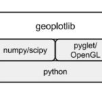
Geoplotlib is a Python visualization library specifically meant for geographical data and creating maps. It can generate elegant interactive graphs using data from Open Street Map. If you want to know more about Geoplotlib, take a look at this blog.


