

Navigating waterways safely is a top priority for all mariners, whether for recreational sailing, commercial shipping, or fishing. While electronic navigation systems like GPS and chartplotters are widely used, NOAA paper charts continue to be indispensable for planning and executing safe voyages. Offered by American Nautical, these charts provide accurate, up-to-date information on coastlines, water depths, hazards, and navigational aids. With NOAA paper charts in hand, sailors can confidently plan routes, mark hazards, and ensure a smooth journey even in areas with limited electronic coverage.
Why Choose NOAA Paper Charts
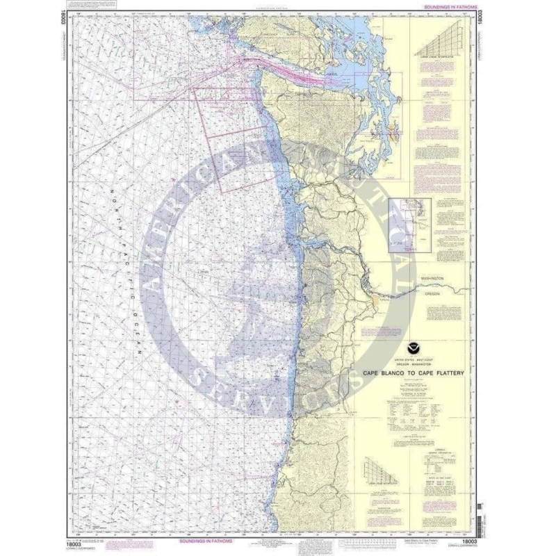
NOAA, or the National Oceanic and Atmospheric Administration, produces charts that are widely recognized for their accuracy and reliability. These charts include a variety of features that are critical for safe navigation:
- Detailed Water Depths: Contours and soundings show water depth to help avoid shallow areas.
- Navigational Aids: Buoys, lights, and markers are clearly marked.
- Hazards: Rocks, wrecks, and other obstacles are highlighted to prevent accidents.
- Latitude and Longitude Grids: Essential for precise positioning and plotting courses.
These features make NOAA paper charts invaluable for professional mariners and hobbyists alike. They provide the information needed to navigate unfamiliar waters, plan routes, and respond quickly to changing conditions.
Advantages of Paper Charts Over Digital Tools
While electronic charts and GPS systems are convenient, paper charts offer unique advantages that make them an essential part of any navigator’s toolkit:
- Reliability: Paper charts function without electricity, satellite signals, or internet connectivity.
- Durability: High-quality charts can withstand rough conditions on board, especially when laminated or kept in waterproof cases.
- Ease of Reference: Charts provide a broad overview that is sometimes difficult to replicate on a small screen.
- Flexibility for Planning: Users can mark potential hazards, note tidal information, or track routes manually.
These benefits make NOAA paper charts a preferred choice for many sailors who want the security of having a backup or a physical reference. They are also highly useful for training, teaching navigation skills, and practicing plotting courses without relying on technology.
How to Read NOAA Paper Charts
Understanding the information presented on a NOAA paper chart is key to safe navigation. Here are some of the critical elements to look for:
- Depth Contours and Soundings: These indicate how deep the water is at various points.
- Symbols for Navigational Aids: Buoys, beacons, and lights are illustrated for guidance.
- Hazard Markers: Wrecks, rocks, and other obstructions are clearly labeled.
- Compass Rose: Shows magnetic variation to assist in taking accurate bearings.
- Latitude and Longitude Lines: Allow for precise location plotting using GPS or traditional navigation techniques.
By learning how to read these charts effectively, sailors can avoid dangerous areas, identify safe anchorages, and plan routes that optimize safety and efficiency.
Tips for Maintaining and Updating Charts
Even though paper charts are durable, they require proper care and updates to remain accurate. NOAA frequently releases updates and corrections that should be incorporated into your charts. Here’s how to keep your charts current:
- Check Notices to Mariners: NOAA issues regular updates highlighting changes in water depths, hazards, or navigational aids.
- Replace Worn Charts: Torn, faded, or outdated charts should be replaced to maintain clarity and safety.
- Annotate New Hazards: Mark any local knowledge, temporary hazards, or changes observed during voyages.
- Use Waterproof Covers: Protect your charts from water, dirt, and wear to extend their lifespan.
American Nautical offers a comprehensive NOAA paper charts catalogue so that sailors can always access the latest, most accurate charts for their voyages.
Who Should Use NOAA Paper Charts
NOAA paper charts are suitable for a wide range of users:
- Recreational boaters who want to plan safe coastal trips.
- Commercial mariners navigating unfamiliar waters.
- Fishermen seeking accurate depth and hazard information.
- Sailing schools and students learning traditional navigation.
- Emergency planners who need reliable backup navigation tools.
Having a physical chart on board not only ensures safety but also builds confidence. It encourages mariners to understand the waters they travel in and make informed decisions, rather than relying solely on digital systems.
Final Thoughts
NOAA paper charts remain an essential part of marine navigation. They complement digital tools, provide a dependable backup, and help mariners plan safe, efficient routes. By using these charts from American Nautical, sailors gain access to the most accurate and up-to-date information available, ensuring peace of mind on every journey. Physical charts also offer a hands-on experience that teaches navigation skills and promotes safer, more informed voyages. Investing in high-quality NOAA paper charts is an investment in safety, preparedness, and confidence at sea.
Frequently Asked Questions
What are NOAA paper charts used for?
They provide detailed information on water depths, hazards, and navigational aids, helping sailors navigate safely.
How often are NOAA charts updated?
NOAA issues updates regularly, which can be incorporated using notices to mariners.
Can paper charts replace GPS navigation?
Yes, they can be used independently and serve as a reliable backup to electronic navigation systems.
Where can I buy NOAA paper charts?
You can purchase them from American Nautical through their NOAA paper charts catalogue.
How do I read depth information on a paper chart?
Depths are shown using contour lines and numbers, indicating water depth at different locations.
Are paper charts still relevant in the digital age?
Absolutely. They provide a reliable, battery-free resource and are often required for safety and regulatory purposes.