


Introduction
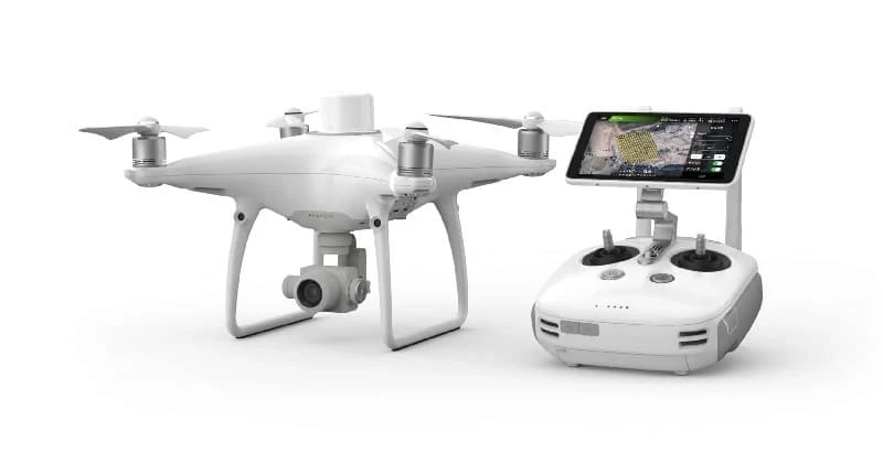
The DJI Phantom 4 RTK (Real-Time Kinematic) is a groundbreaking drone that has significantly impacted the field of aerial mapping and surveying. With its precise positioning capabilities and cutting-edge technology, it has become a game-changer for professionals in various industries, from agriculture to construction and beyond. In this article, we will explore the features, benefits, and applications of the DJI Phantom 4 RTK, showcasing its importance in revolutionizing precision aerial mapping.
- The Evolution of Aerial Mapping
Aerial mapping has come a long way since the days of traditional surveying methods. Traditional surveying techniques involved time-consuming processes that required extensive manpower and often yielded results with limited accuracy. The advent of unmanned aerial vehicles (UAVs) or drones has transformed the field of aerial mapping, making it more efficient, cost-effective, and accurate than ever before.
- The DJI Phantom 4 RTK: A Game-Changer
- Precise Positioning
The key feature of the DJI Phantom 4 RTK is its real-time kinematic (RTK) technology. This technology allows the drone to achieve centimeter-level accuracy in its positioning, thanks to the integration of GNSS (Global Navigation Satellite System) receivers. The use of both GPS and GLONASS satellite systems ensures that the drone maintains its accuracy even in challenging environments with signal interference.
- High-Quality Imaging
Equipped with a 20-megapixel camera with a 1-inch CMOS sensor and mechanical shutter, the Phantom 4 RTK captures high-resolution images and provides excellent results in various lighting conditions. The mechanical shutter eliminates the rolling shutter effect, ensuring distortion-free images even when the drone is in motion.
- Time-Saving Efficiency
One of the most significant advantages of the Phantom 4 RTK is its ability to cover large areas in a relatively short amount of time. This drone\'s high-speed flight capabilities, combined with its precision, allow surveyors and mappers to complete projects quickly and efficiently.
- Seamless Data Integration
The Phantom 4 RTK seamlessly integrates with popular mapping software such as DJI Terra and Pix4D, making it easy to process and analyze collected data. This integration streamlines the workflow and enables professionals to generate accurate 2D and 3D maps, models, and orthomosaics.
III. Applications of the DJI Phantom 4 RTK
- Agriculture
In the agriculture industry, the Phantom 4 RTK plays a crucial role in precision farming. It helps farmers monitor crop health, assess irrigation needs, and create detailed field maps. By identifying areas that require specific attention, farmers can optimize their resources and increase crop yields while reducing waste.
- Construction and Surveying
Construction and surveying professionals benefit from the Phantom 4 RTK\'s precise mapping capabilities. It aids in site planning, progress monitoring, and stockpile volume calculations. With accurate data, construction projects can stay on schedule and within budget.
- Environmental Monitoring
Environmental agencies and researchers use the Phantom 4 RTK to monitor and assess natural ecosystems. It assists in tracking changes in terrain, wildlife habitats, and vegetation cover, helping scientists make informed decisions about conservation efforts and land management.
- Infrastructure Inspection
The drone\'s high-resolution imaging capabilities make it an ideal tool for inspecting critical infrastructure such as bridges, power lines, and pipelines. It allows inspectors to identify potential issues early, reducing the risk of accidents and costly repairs.
- Disaster Response
During natural disasters such as hurricanes, floods, or wildfires, the Phantom 4 RTK can provide valuable aerial data to first responders and emergency management teams. This data aids in assessing damage, planning rescue operations, and coordinating disaster response efforts.
- Conclusion
The DJI Phantom 4 RTK has revolutionized precision aerial mapping and surveying across various industries. Its real-time kinematic technology, high-quality imaging, and seamless data integration have made it an indispensable tool for professionals seeking accuracy, efficiency, and cost-effectiveness in their projects. As technology continues to advance, drones like the Phantom 4 RTK will undoubtedly play an increasingly important role in shaping the future of aerial mapping and surveying.